


We’ve come to expect a lot from our smartphones, and that includes decent maps.
Apple’s decision to remove Google Maps from the iPhone 5 and its latest software (iOS 6) in favor of its own fledgling Maps app has resulted in a black eye for the company, normally known for putting out pristine products. Sure, the new app includes fancy “flyover” images and turn-by-turn voice navigation. But some of the maps’ errors and the lack of basic public transit data have left some new iPhone owners feeling lost.
Fortunately, while Apple is improving Maps, there are other map apps available for iPhone users, whether they’re using an iPhone 5 or an older phone model upgraded to iOS 6.
For the past several days, I’ve been finding my way with Waze, made by a company of the same name; Scout by Telenav; and Fullpower’s MotionX GPS Drive. I mostly tested these on the iPhone 5 while driving a rented car, though I also tested some apps while walking around Manhattan. A lot of consumers use their map apps to search for addresses, or for local places — like the coffee shop, movie theater or pizza place — but I focused primarily on the overall user experience and the turn-by-turn navigation features of these apps.
All three apps I tested offer turn-by-turn voice guidance. The Waze app, which turns the road into a kind of social network, is free. So is Scout, which currently comes with one year of free voice guidance through an app upgrade called Scout Plus. MotionX GPS Drive costs 99 cents for the app download, and three dollars a month or $10 a year for the voice-navigation services.
It’s worth noting that there are many other ways to get good directions. Microsoft’s Bing search app has a Maps section that offers (voice-free) turn-by-turn walking, transit and driving directions. AOL’s MapQuest app offers voice-guided turn-by-turn navigation. Those who still want to use Google Maps on the new iPhone can do so from a mobile Web browser, though only Google Android phone users get the full features of Google’s Maps app. Nokia’s maps are available through a Web browser, too.
Apps from nav makers Garmin, Navigon (which is owned by Garmin) and TomTom are more expensive — ranging from $40 to $50 for the U.S. maps alone. While they include dozens of downloadable maps that work offline, and more closely mimic the experience you might get from a portable navigation device, other apps tested just as well as these did, and cost a lot less.
I should also note that my experience with Apple Maps really wasn’t that bad. When I first typed in my home address, Apple Maps directed me to New Jersey instead of midtown Manhattan. But most other times the app worked fine, whether I was driving across Long Island, through the complicated matrix of New York and New Jersey highways, or on dirt roads in sparsely populated areas of Pennsylvania.
But it’s Waze, which became available in the U.S. in 2010, that might become my new favorite navigation app.
Waze offers offers turn-by-turn voice navigation, 3-D views of the road and voice commands. The unique thing about Waze is that it has, over time, created a network in which Waze users can warn each other of oncoming traffic, hazardous objects and hidden speed traps. There’s also a gaming element to the app: You win points for sending in reports, and the more mileage you rack up the more features you unlock. Occasionally, a local deal will pop up on the Waze map, like a soda for 75 cents at the gas station you’re approaching.
In my experience, almost every report of a police officer or a car parked on the shoulder of the highway was accurate. If the report was inaccurate, I could say the cop or the car was no longer there, or I could send a report of my own.
Since all of this activity can be distracting, Waze has taken steps to keep users from typing while driving. It wouldn’t let me enter in an address unless I indicated I was a passenger (although, technically, a driver could easily lie and tap the button that says they’re a passenger).
The app has a motion-controlled input feature as well. By hovering my hand over the app’s screen, I could activate voice command and search for directions that way.
Even as I tested other apps, I wanted to go back to Waze to see what other users had to report.
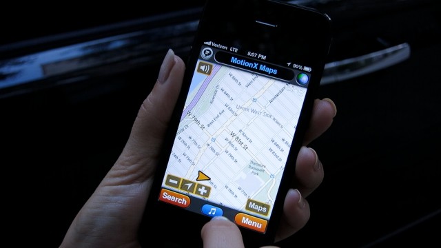
MotionX GPS Drive is made by California-based Fullpower. The company’s nav app, geared towards drivers, packs a lot of features and personality for a small price. Like Waze, MotionX GPS Drive has 3-D maps and voice-command options through the Siri button on the iPhone 5’s virtual keyboard. Unlike Waze, MotionX’s voice guidance is free only for the first 30 days, and after that requires a monthly ($3) or annual ($10) subscription.
A couple of voice options come with that subscription: Heather, a synthesized voice, and the natural-sounding Karen. The fun human-voice options, like the London East-Ender and the Cougar (“You win points for creativity,” the Cougar purred when I rerouted) are 99 cents each.
This app has a slightly confusing interface. In order to change my destination while in map view, I had to go from the map to Menu to Search to a wheel of options that separated “Search” from “Address” and included a tab for Wikipedia and my social networks. If I was in a real jam while driving, it wasn’t the best option for getting directions.
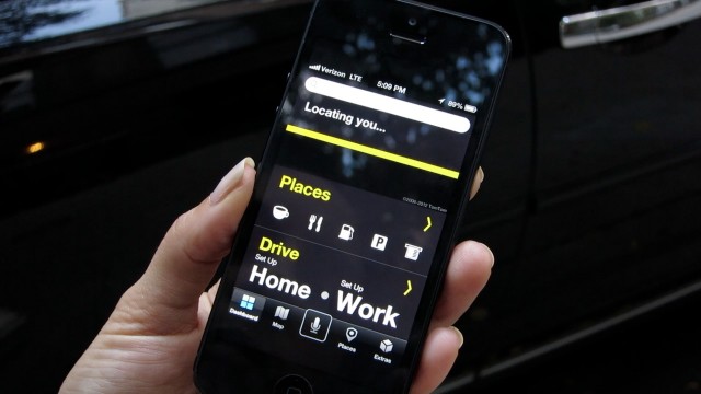
Scout, made by Telenav, has a more straightforward interface, with big, bold lettering. A single search bar and a “Places” section pops up whenever you open the app, for quick access to local food stops or gas stations. The app was also super fast when it came to search results. It accurately auto-filled some of the addresses I typed in the search bar, and within a couple seconds, I had directions.
As much as I liked Scout’s design, I wouldn’t use it without Scout Plus. For now, the company is offering the $10 Scout Plus subscription for free, trying to lure in customers.
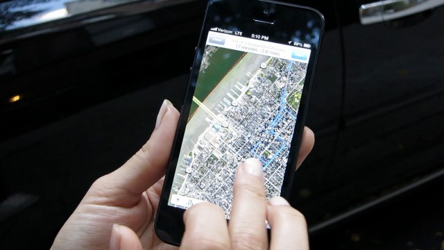
Scout Plus enables turn-by-turn voice directions and other features (after using Scout Plus, though, I kind of wished I wasn’t getting the voice directions: Scout’s combination of a human voice with a synthesized voice can be jarring.) Scout Plus also offers regional, downloadable maps, so even if I lost my data connection and took a wrong turn, Scout would adjust and send me in the right direction.
Many navigation apps promise offline directions, which means they’ll still show a map when your phone has lost its data connection. But that usually depends on whether you’ve preloaded the map before you lost your connection. Others will continue to guide you using your smartphone’s built-in GPS if you stay the course, but if you make a wrong turn, you’re out of luck.
One drawback of these apps is that they’ll drain your iPhone’s battery, as I quickly learned, so for long trips it’s essential to bring a car charger or an iPhone power pack. Otherwise, you might end up doing what I did — relying on a laptop for backup power, or stopping somewhere to ask a real, live human being whether you’re headed the right way.


